About
Buying or own a piece of hunting Land?

Why not know whatcha have on it??
Our Aerial Wildlife Survey Service can provide accurate and current numbers of Deer, Turkey and Predators on your property.
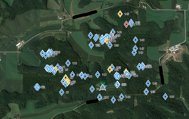
You will be provided with a Google Earth image showing exactly what is on the property. This survey shows Blue markers for Doe and immature Bucks. Yellow for Mature Bucks and Red markers for the Whoppers.
Property Improvement
Placing Stands, Food Plots and other improvements are big decisions. Knowing where Game is concentrated allows you to locate Stands in the best locations possible. Trails are easily spotted in Winter and intersections can be great places to locate a Stand!
Due to obvious legal and ethical reasons, the further in time that the Survey is removed from when property is hunted, the more likely it will be that the purpose of the UAS operation is considered to be scouting and not hunting.
